The Pear Lake wildfire as shown in the BC Wildfire Service's update video on July 31. (Image Credit: BC Wildfire Service)
Pear Lake Fire

Hundreds of new CRD, TNRD properties under evacuation order due to Clinton-area wildfire

Jul 31, 2026 | 8:44 AM

UPDATE (12:00 p.m.): Residents in an additional 375 properties within the TNRD are being ordered to evacuate.

Effective at 11:00 a.m. Friday, the TNRD says its evacuation order in response to the Pear Lake wildfire has been expanded to include the community of Loon Lake and properties along Highway 97 from Loon Lake Road to south of Scottie Creek Road.

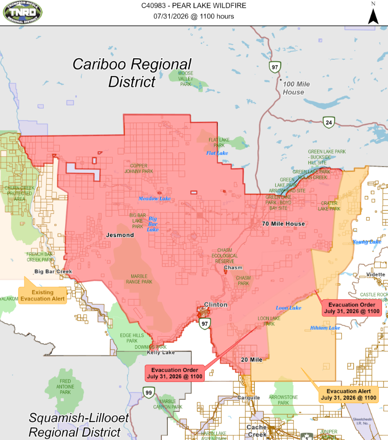
The evacuation order now covers nearly 1,494 addressed properties in Electoral Area “E.”


(Image Credit: TNRD)

The TNRD’s evacuation alert has been expanded. It’s in place for nearly 213 properties within Electoral Area E. Impacted areas include:

  • 3700 to 3480 Little Green Lake Rd.;
  • Pressy Lake;
  • Hihium Lake;
  • 6832 to 6784 North Bonaparte Rd.;
  • 6820 Lost Valley Rd.;
  • 2345 Blue Goose Rd.;
  • 280 Eagan-Bonaparte Lake FSR;
  • 1605 Boule-Young Lake Rd.;
  • 5885 Clinton-Upper Loon Lake FSR;
  • 4005 to 4460 Highway 97;
  • 1015 to 1044 Cody Rd.;
  • 3876 to 4168 Hills Frontage Rd.;
  • 4133 to 4201 Mickey Frontage Rd.;
  • 3880 to 4209 Old Cariboo Rd.;
  • 992 to 1016 Ray Rd.; and
  • Any other properties as outlined on the attached map

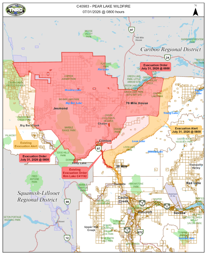
EARLIER: KAMLOOPS — Residents in more than 900 additional properties have been ordered to evacuate due to the massive Pear Lake wildfire near Clinton.

The Thompson-Nicola Regional District (TNRD) says its evacuation order has been expanded to include South Green Lake and the Hutchison Road and Thibert Road areas.

In total, nearly 1,119 addressed properties in Electoral Area “E” (Bonaparte Plateau) are on evacuation order. Nearly 536 properties were added as of the TNRD’s update at 8:00 a.m. Friday (July 31).


(Image Credit: TNRD)

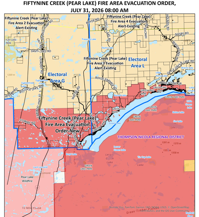
Also at 8:00 a.m. Friday, the Cariboo Regional District (CRD) issued a new evacuation order for nearly 366 parcels encompassing 269 house points over 8,913 hectares, on the north end of Green Lake.

The CRD’s evacuation order was issued less than a day after it issued two new evacuation alerts for areas impacted by the Pear Lake wildfire.


(Image Credit: CRD)

The TNRD has also expanded its evacuation alert area for the Pear Lake wildfire to include Pressey Lake. In total, 564 addressed properties in Electoral Area “E” are under evacuation alert, including Loon Lake and 16 Mile. The TNRD notes several areas previously under evacuation alert are now under the evacuation order.

Residents in the CRD and TNRD whose properties are now under evacuation order must leave immediately. Those wishing to receive Emergency Support Services are asked to register online and report to the reception centre at 4249 18th Ave. in Prince George. Highway 97 from the 70 Mile House area to the Village of Clinton is closed due wildfire.

Residents whose properties are under evacuation alert must be prepared to leave on very short notice.

As of its latest update Friday morning, the BC Wildfire Service says the Pear Lake fire is measured at 72,217 hectares, or 722 square kilometres in size.

A planned ignition was cancelled Thursday due to site conditions, though one went ahead of Wednesday. Crews will assess conditions on Friday.