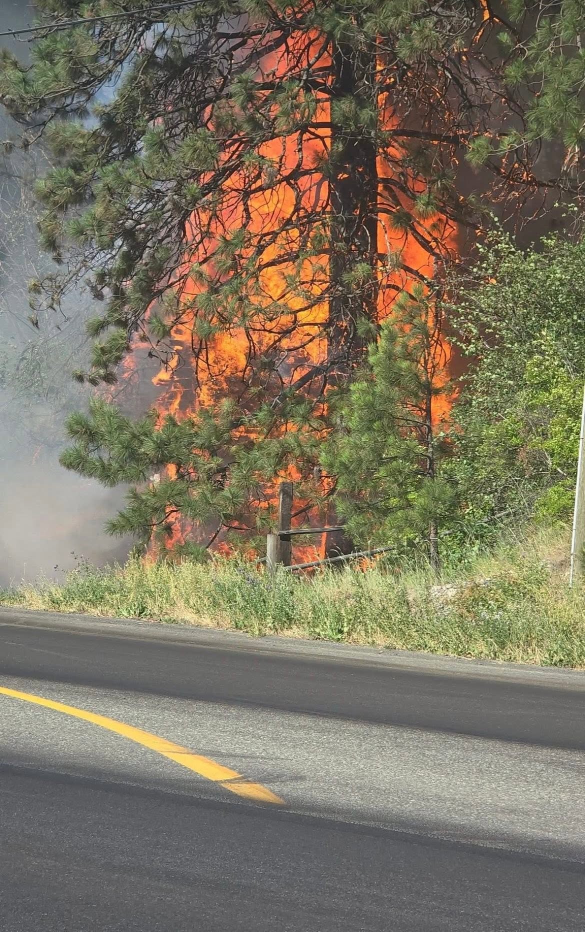
(Image Credit: Facebook / Randy James)
Wildfire Season

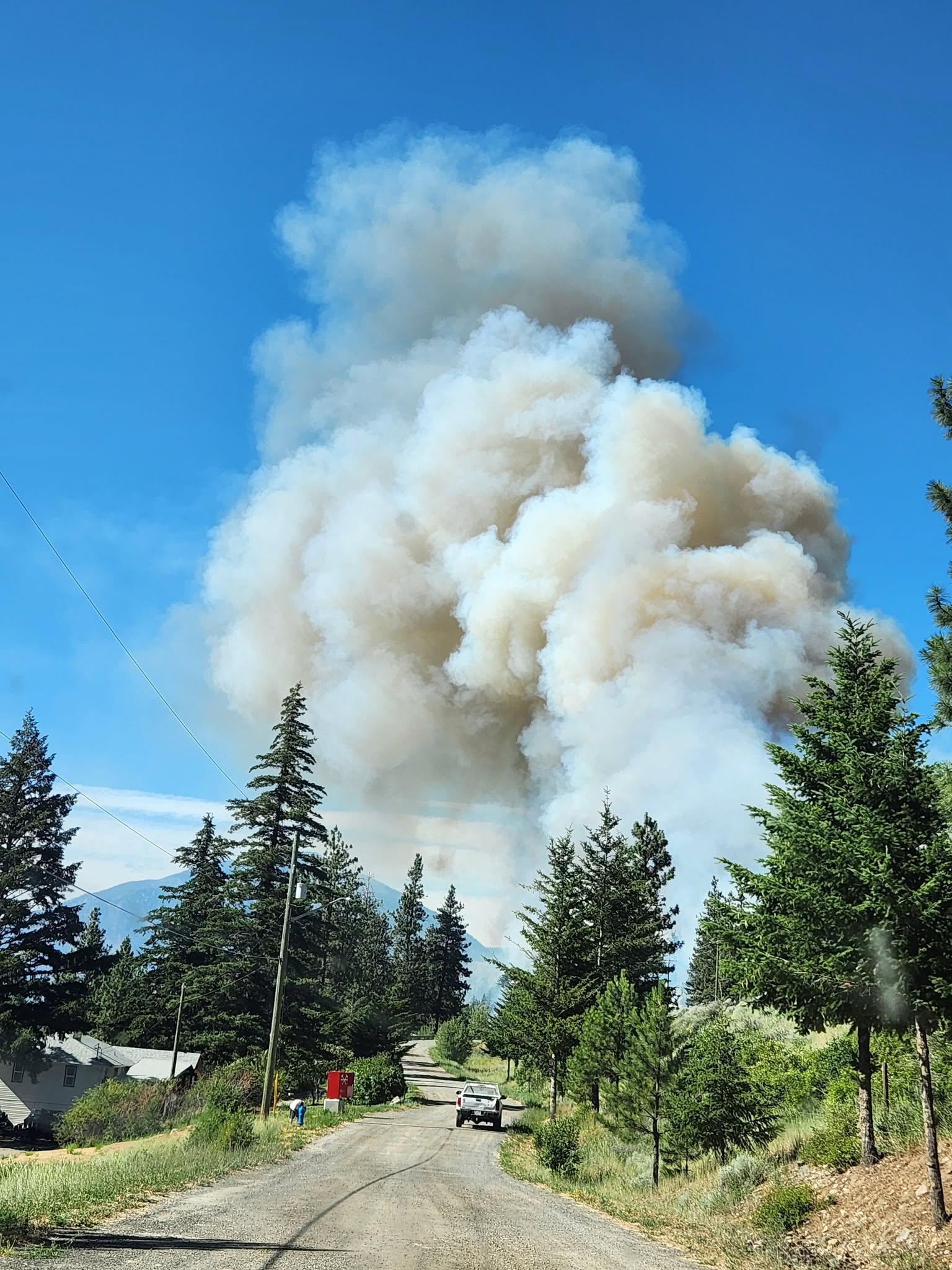
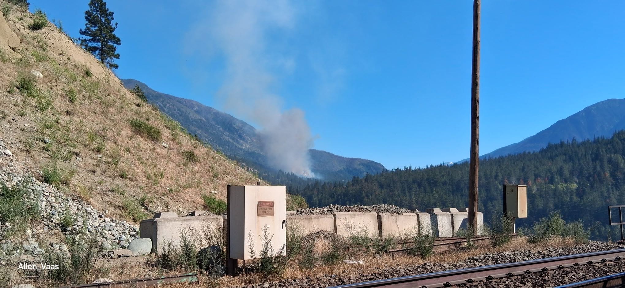
Evacuation orders, alerts issued as wildfire burns along Highway 1 near Lytton

Jun 19, 2026 | 6:05 PM

LYTTON, B.C. — UPDATE (10:15 p.m.): The Thompson-Nicola Regional District (TNRD) has issued an evacuation order for 13 properties in proximity of the Saw Creek wildfire.

The regional district says the order covers properties east of Highway 1 north from Florence Road to Airport Road.


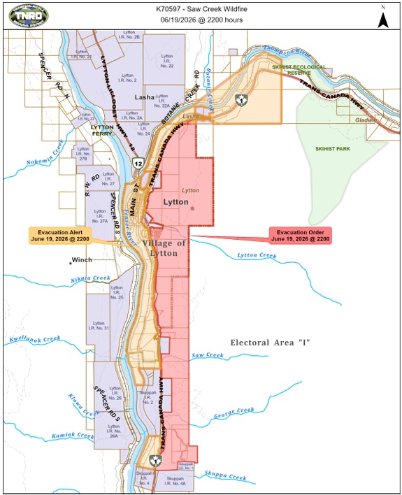
(Image Credit: TNRD)

Occupants of properties within the map area are ordered to leave immediately.

Areas west of Highway 1, including the village of Lytton, are under evacuation alert.

For more information, visit this page.

The BC Wildfire Service, meantime, says the fire is now measured at 200 hectares.

Sixty-three BCWS firefighters are working on the blaze, joined by Lytton Fire Rescue personnel, aerial resources and structural protection units.

“Crews are working along the northwest and south flanks of the fire to establish controls lines, while helicopters assist with bucketing operations to decrease fire behaviour,” says the BCWS website.

UPDATE (8:52 p.m.): The TNRD has issued notice that they are working on issuing an evacuation order for properties in Electoral Area ‘I’.

The following was posted to Facebook.

The Saw Creek wildfire situation has rapidly escalated this evening (June 19, 2026) in the Highway 1 corridor in areas north and south of Lytton.

A formal Evacuation Order will be released shortly by the TNRD for Electoral Area “I,” for an area east of Highway 1 from Florence Road north to near Skihist Park.

Residents in this area who need Emergency Support Services are asked to go to the Battlefield Community Hall, located at 1756 Battlefield Road within Lytton First Nation.

Additionally, the TNRD will be issuing a formal Evacuation Alert on behalf of the Village of Lytton. At this time, the Village of Lytton is not on Evacuation Order.

An official map from the TNRD highlighting the effected area has not yet been released.

UPDATE (8:00 p.m.): The Village of Lytton has issued an evacuation alert for all residents in the village. Approximately 20 homes have been rebuilt since the 2021 fire, with around 75 residents calling Lytton home.

The following was posted to the Village’s website on Friday evening:

There is an uncontrolled wildfire south of the Village of Lytton.  An EVACUATION ALERT has been issued for residents in the Village of Lytton.

There is no need evacuate at this time, but be prepared to do so on short notice if an evacuation order is issued.

If an evacuation order is issued, evacuees can report to the Lytton First Nation Battlefield Community Hall for shelter.

We will share additional information as it becomes available.

UPDATE (6:45 p.m.): The Saw Creek wildfire has now grown to 100 hectares.

According to Drive BC, Highway 1 is now closed between Ashcroft and Boston Bar to allow crews to work the fire.

BC Wildfire Service says the fire is “burning Rank 4 and 5, meaning a highly to extremely vigorous surface fire with an organized crown fire and moderate- to long-range spotting. Hot and dry conditions have made fuels highly susceptible to ignition.”

Lytton Fire Rescue has joined BCWS to fight the fire, along with aircraft.

EARLIER: BC Wildfire Service (BCWS) crews are responding to a new wildfire start south of Lytton Friday afternoon (June 19).

The Saw Creek fire was discovered Friday burning on the east side of the Trans Canada Highway, just north of the Skuppah 2B reserve.

As of about 5:30 p.m. Friday, BCWS estimated the blaze at 10 hectares and says it is caused by human activity.

There are no evacuation orders or alerts associated with the fire as yet.


(Image Credit: Facebook / Jessie Leech)

(Image Credit: Facebook / Shirley Karhu Mackay)

(Image Credit: Facebook / Allen Thom)