Pear Lake Fire, Aug. 3. (Image Credit: BC Wildfire Service)
Pear Lake and French Bar Creek Fires
Evacuation alerts expand for Clinton-area wildfires
Aug 5, 2026 | 5:13 PM
-
Share on Facebook
-
Share on Bluesky
-
Share on X
- Copy Link
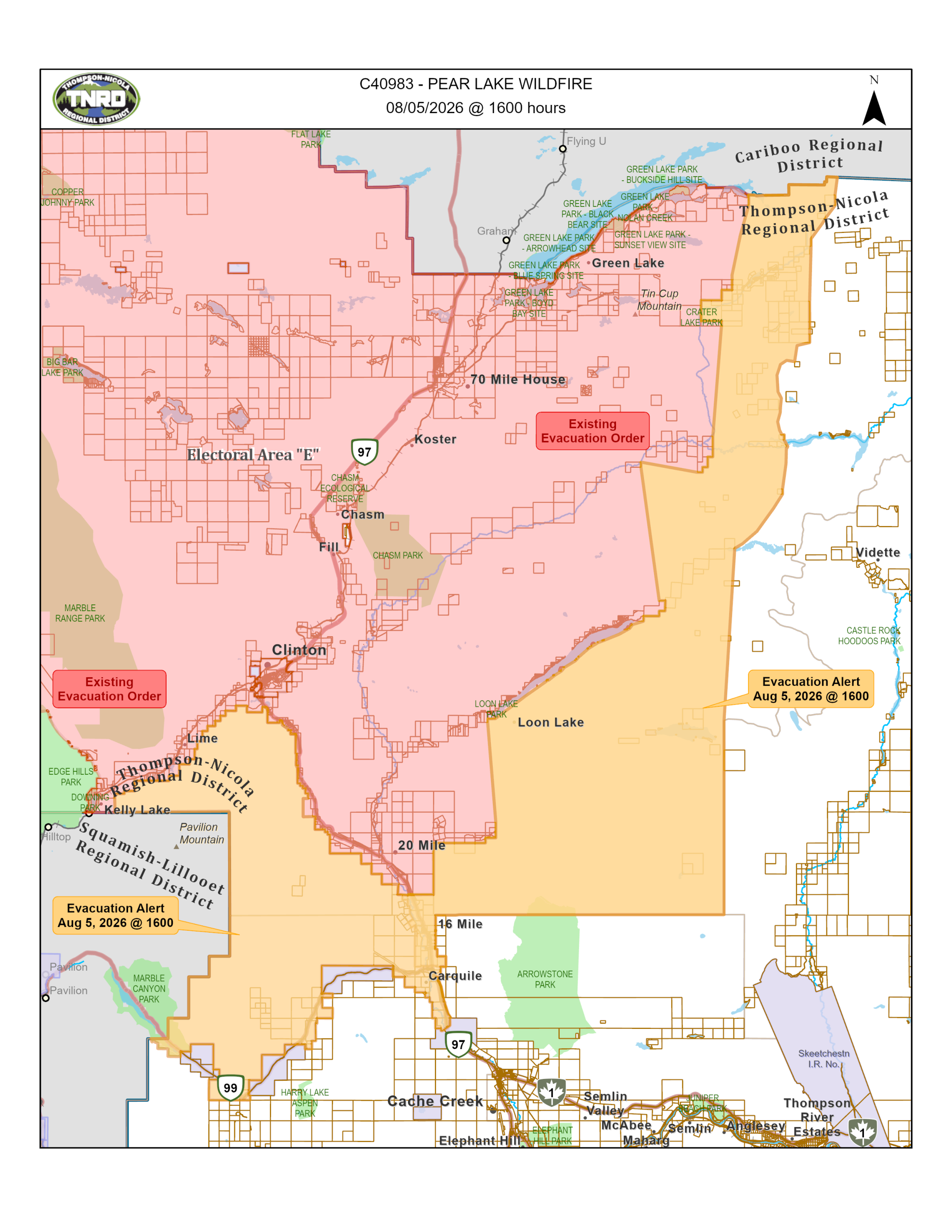
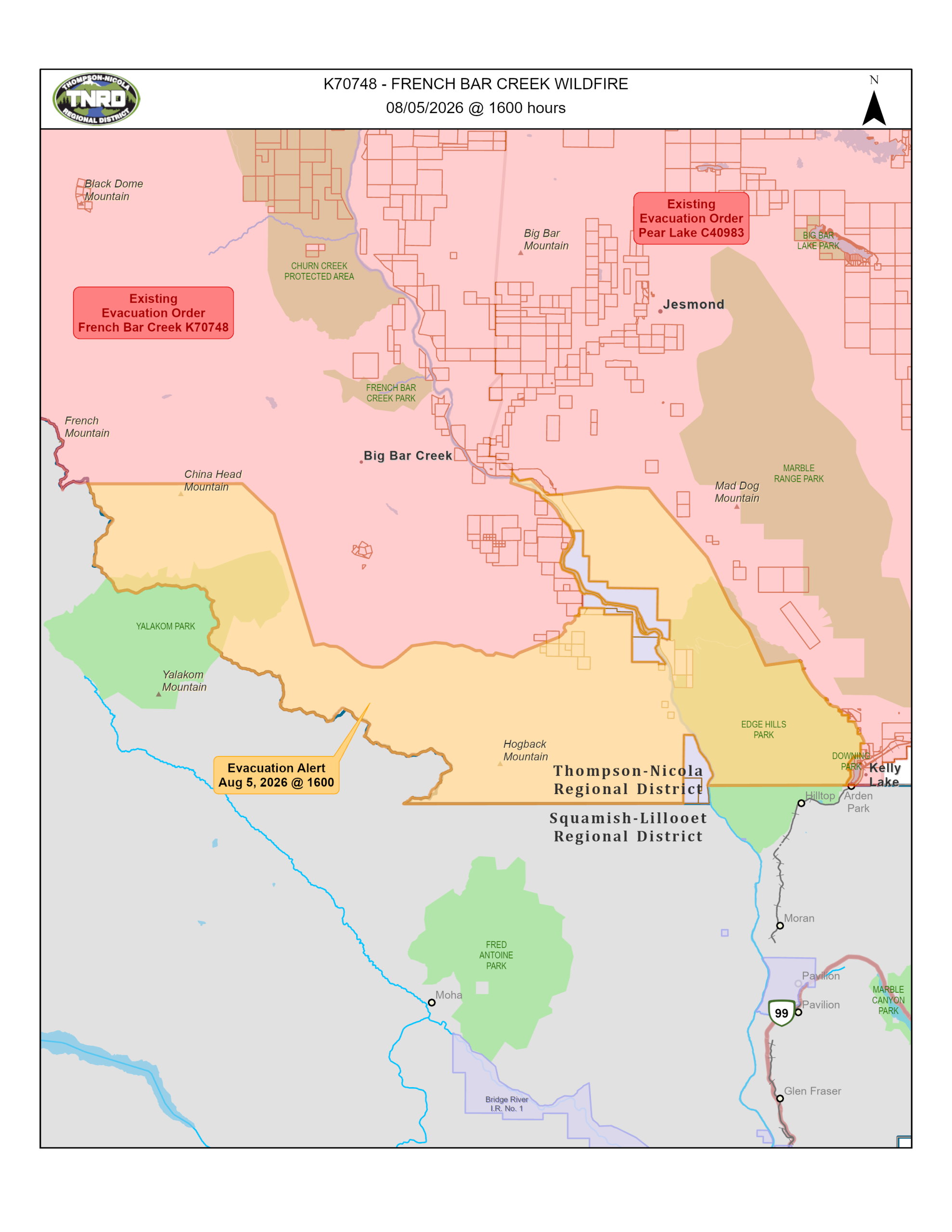
CLINTON, B.C. — The Thompson-Nicola Regional District (TNRD) has enacted a pair of new evacuation alerts in the South Cariboo as the wildfire picture evolves.
For the Pear Lake wildfire in the Clinton area, 16 new properties are under alert south of Clinton, bringing the alert total in the area to 229 properties, up from the previous estimate of 213 properties.
The alert area includes the following properties and stretches all the way down to Highway 99 in the south:
- 3700 to 3480 Little Green Lake Rd
- Pressy Lake
- Hihuim Lake
- 6832 to 6784 North Bonaparte Rd
- 6820 Lost Valley Rd
- 2345 Blue Goose Rd
- 280 Eagan-Bonaparte Lake FSR
- 1605 Boule-Young Lake Rd
- 5885 Clinton-Upper Loon Lake FSR
- 2811 to 5521 Hwy 97
- 1015 to 1044 Cody Rd
- 3876 to 4168 Hills Frontage Rd
- 4133 to 4201 Mickey Frontage Rd
- 3880 to 4209 Old Cariboo Rd
- 1468 and 2628 Hwy 99
- 3515 and 3540 Jackson Rd
- 992 to 1016 Ray Rd