Weeklong special weather statement lifted as Kamloops-area temperatures return to seasonal levels
-
Share on Facebook
-
Share on Bluesky
-
Share on X
- Copy Link
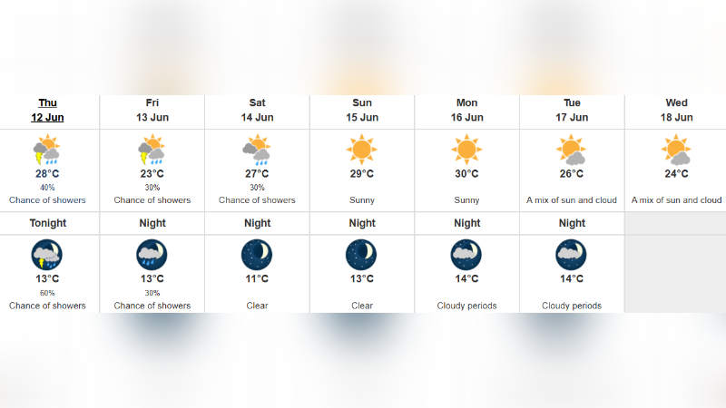
KAMLOOPS — Environment Canada has ended a week-long special weather statement that blanketed much of southern B.C. with warmer than normal temperatures.
The final special weather statements that covered the North and South Thompson, the Shuswap, the Nicola Valley, and the Fraser Canyon were lifted Wednesday (June 11) night. A similar alert for areas like Metro Vancouver and Victoria was lifted earlier Wednesday.
Several temperature records were set over the course the an “early season heat event,” including in Kamloops on Sunday (June 8). Lytton was the country’s hot spot for four days in a row Saturday to Tuesday, while Lillooet was the hot spot Wednesday at 34.4 C.
While the spell of warm weather did not cross into the threshold for a heat warning in Kamloops, both the City and Interior Health issued reminders to people to be aware about the potential dangers of heat.