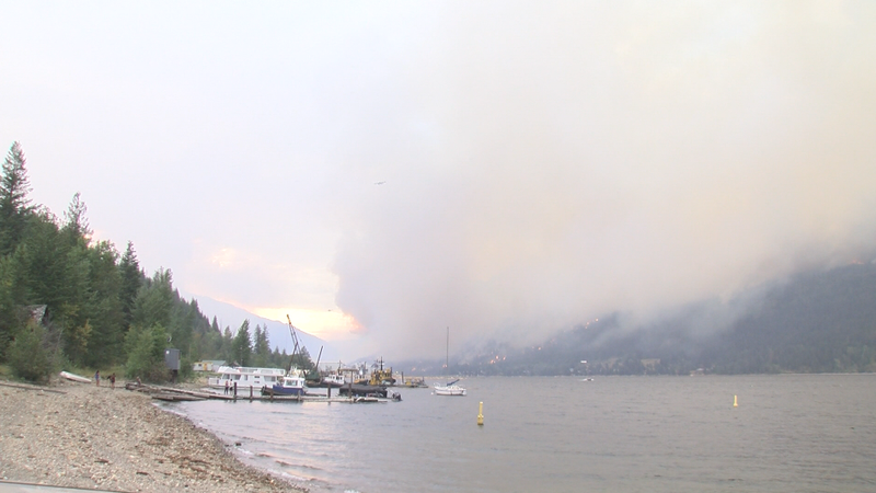
Image Credit: CFJC Today
WILDFIRE SEASON 2023

Surprise northerly winds sank BC Wildfire projection on Lower East Adams Lake fire

Aug 3, 2023 | 4:48 PM

KAMLOOPS — On Tuesday (Aug. 1), the Columbia Shuswap Regional District (CSRD) tweeted that a BC Wildfire Service (BCWS) model showed ‘minimal fire growth in the area of concern for Dorian Bay,’ a small community along the eastern shore of Adams Lake.

The CSRD also posted an update to their website stating, ‘The BC Wildfire Service is reporting there is no threat to the communities in the Lower East Adams Lake area despite significantly increased smoke.’

Those two statements preceded a mass evacuation of the community only hours later due to the encroaching Lower East Adams Lake wildfire. That left many residents questioning how the model got it wrong.

BC Wildfire Information Officer for the Adams Complex, Forrest Tower, addressed that very issue on Thursday afternoon after reporting no loss of structures on Wednesday night due to the blaze.

“I know there is a lot of discourse and rightfully so about the messaging that the BC Wildfire Service shared with residents,” began Tower. “That is the data we had on hand. That is what weather models were showing and that is with the on-the-ground fire behavior. That is what we were working on for best available data to make those decisions on.”

Tower noted that a wind shift that was not forecast spurred fire behavior towards the community.

“We had a northerly wind and that was not in any long-term or short-term forecast,” said Tower. “It wasn’t in a Canadian, European or American long-term forecast. Those northerly winds that we experienced were not built into that growth modeling product.”

“A model can not pick a right or wrong answer. What it can do is provide a tool to inform decision-making. We can’t make decisions based on data we don’t have,” added Tower.

The Lower East Adams Lake wildfire is listed at 2,527 hectares as of Thursday afternoon.