(Image credit: CFJC Today/File photo).
River Watch

Snowpack spikes in North and South Thompson basins

Jun 8, 2022 | 10:07 AM

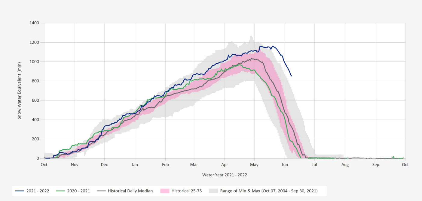
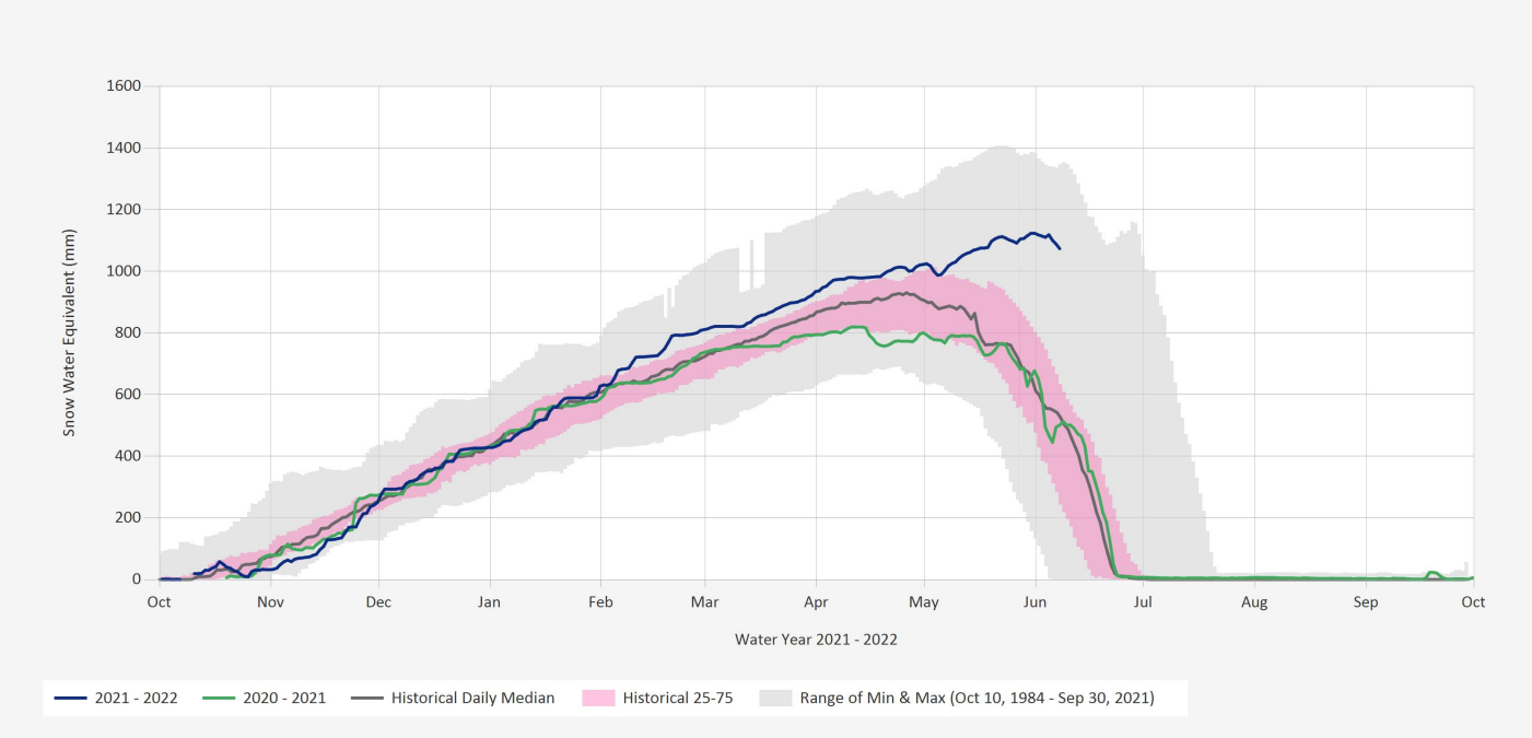
KAMLOOPS — The North and South Thompson basins both saw substantial snowpack increases as of June 1, 2022, relative to seasonal norms.

In an update to B.C.’s map of snow basin indices Wednesday (June 8), the North Thompson is now listed at 175 per cent of normal, up from 142 per cent on May 15. The South Thompson saw a larger increase, going from 113 per cent snowpack on May 15 to 157 per cent on June 1.

According to the B.C. River Forecast Centre (BCRFC), 130 per cent is well above normal snowpack.

Kostal Lake in the North Thompson (Image credit: BC River Forecast Centre).
Celista Mountain in the South Thompson (Image credit: BC River Forecast Centre).

At the same time in 2021, the North Thompson was at 98 per cent normal while the South Thompson was at 69 per cent.

Meanwhile, the Upper Columbia basin is at 165 per cent, up from 123 per cent. Previously, the BCRFC stated the South Thompson’s basin could have been slightly higher than the snow basin index suggests due to it bordering the North Thompson and Upper Columbia. All three basins have a higher risk of flooding.

Significant risk for high freshet flows

In its latest snow conditions and water supply bulletin for June 1 released on Wednesday, BCRFC says the delayed melt of mountain snowpack leaves B.C. with a high risk of flooding.

Six stations measured record high snow values for June 1: the North and South Thompson basins, along with the Upper Fraser East, Quesnel, and Upper Columbia.

According to BCRFC, snowpack melt has been delayed by two to four weeks due to cooler weather in April and May. Where half of the accumulated snowpack typically melts by June 1, BCRFC says only 19 per cent has melted this year.

However, BCRFC says it’s not unusual to have high snowpack values for June 1 or June 15, with 2011 and 2012 recording high values for June 1.

BCRFC says weather conditions for June through July will determine the timing, magnitude, and rate of snowmelt. Snowmelt-driver flows can worsen with heavy rainfall.

The next snow conditions and water supply bulletin is scheduled to be released on June 17.

Locally, the City of Kamloops will provide an update to its freshet response Thursday (June 9) afternoon from the Sandman Centre parking lot.