North Thompson River, June 8, 2021 (Image Credit: CFJC Today)
Disaster Prep

Floods or fire: Kamloops may face catch-22 with delayed snowmelt

Jun 8, 2022 | 4:14 PM

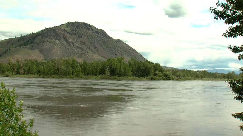
KAMLOOPS — The North and South Thompson basins both saw substantial snowpack increases as of June 1, 2022, relative to seasonal norms. In an update to B.C.’s map of snow basin indices Wednesday (June 8), the North Thompson is now listed at 175 per cent of normal, up from 142 per cent on May 15. The South Thompson saw a larger increase, going from 113 per cent snowpack on May 15 to 157 per cent on June 1.

Snowpack melt has been delayed by two to four weeks due to cooler weather in April and May. Where half of the accumulated snowpack typically melts by June 1, the B.C. River Forecast Centre (BCRFC) says only 19 per cent has melted this year. The threat of heavy rain has the BCRFC worried about potential flooding in the region.

“We are now in that process where the snow is melting day by day. And then if you add rain to that you are going to increase the river response, but rain falling on a snowpack that is melting actually just washing the snow quicker. You can actually end up getting a triple effect from it,” said Hydrologist Jonathan Boyd.

While the June numbers may jump off the page, the can easily be skewed, especially this year as the melt is two to four weeks behind a normal spring. Despite that, the North Thompson remains at risk.

“The North Thompson in particular is one that has been above normal, even since April 1. It is a higher-risk site. We do have one station that was at an all-time record for the North Thompson. It doesn’t have a long record; it’s Cooke Creek with 13 years,” added Boyd.

As the high elevation snowpack remains in the North and South Thompson basins, and summer quickly approaches, the Kamloops area is facing a potential catch-22 — floods or fire.

“There are two sides to that coin. We really need the rains and the coolness of June; this is something we count on every year to help us get through the fire weather season of mid-summer. I’m really happy it’s going the way it is. May was cold and we were dry, so we need the rain,” said Environment Canada Meteorologist Doug Lundquist.

Beyond the rain, Lundquist is most concerned about potential thunderstorms in the region as they are extremely hard to predict more than a few hours in advance. Thankfully, he says the Interior is currently in a sweet spot weather-wise, with temperatures still below seasonal norms of early June.

“The good news is the forecast is for neither too hot nor too cold coming up, nor too wet or too dry. It’s kind of in that sweet spot in there. There is, over the next five days, about 50 millimetres of rain forecast spread out over the five days,” reported Lundquist.

As we move closer to the summer, the hydrological forecast changes almost daily with Boyd suggesting concerned citizens keep their eyes on the advisory pages.

“The hydrological models will change every day based off what the weather forecast is. We are in a period where it is going to be rapidly changing and it’s not like the snow bulletin on April 1 — which gives a general idea of what to expect for the season. We are now down into the daily operations side,” said Boyd.

The City of Kamloops is set to discuss the latest snow bulletin and it’s potential effect on the city, Thursday afternoon.