High river levels in Merritt in spring of 2020 (Image Credit: CFJC Today / Kent Simmonds).
FLOOD UPDATE

Several communities in interior B.C. watching rising river levels

Jun 5, 2022 | 9:44 AM

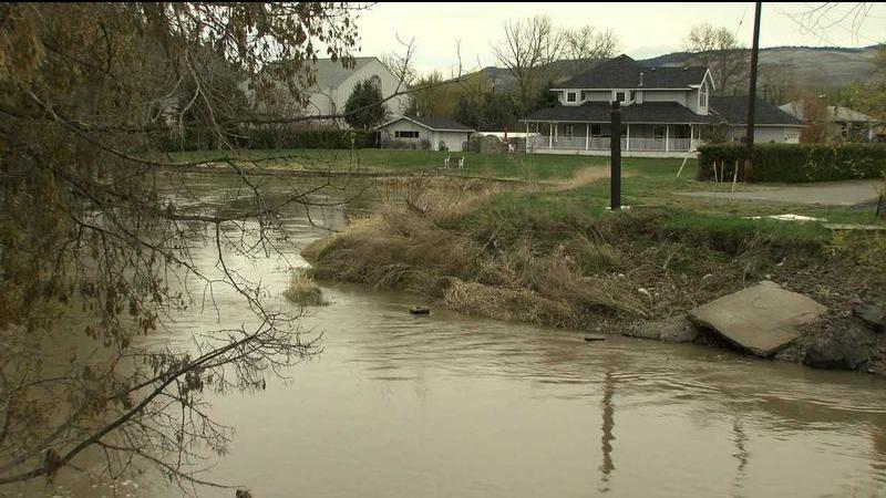
KAMLOOPS — As a low-pressure system brings moderate-to-heavy rainfall and “unsettled weather” to the B.C. Interior, several communities are keeping a close watch on river levels.

There is a flood watch in effect for Lower Nicola River downstream of Spius Creek, as well as Nicola River near Spence’s Bridge. UPDATE: The flood watch was downgraded to a high streamflow advisory at 1 p.m. on Sunday (June 5).

A flood watch is issued when river levels are rising and could exceed bankfull. Flooding of areas adjacent to the affected river may occur.

Steven Rice is an electoral area director for the Thompson-Nicola Regional District and told the Canadian Press that he returned to his Spence’s Bridge home last week after evacuating during last November’s floods.

Rice says the Nicola River is a raging mass of muddy brown water that rose more than a foot and a half since Friday. He says the TNRD emergency operations centre is queued up to issue evacuation alerts and orders if they become necessary.

High streamflow advisories are also in place for a number of rivers through the interior. That means that river levels are rising or expected to rise rapidly, but that no major flooding is expected. Minor flooding in low-lying areas is possible.

The Thompson Region, including the Deadman River, Bonaparte River, Cache Creek and surrounding tributaries are under a high streamflow advisory.

The Cariboo plateau, including the Nazko River, West Road River, Baker Creek and tributaries to the west of Quesnel are also under a high streamflow advisory.

The Cariboo Regional District (CRD) activated their Emergency Operations Centre on Friday (June 3) in response to the advisories and forecast weather trends.

Cariboo residents can sign up for emergency alerts on the CRD website. If sand or sandbags are needed, the CRD says residents can call the public information line at 1-866-759-4977.

The City of Williams Lake also activated its EOC in response to increased water load at a historic beaver dam site high above Juniper Street off South Lakeside Drive, according to a news release on their website.

The City reduced the water level by around six inches, with controlled release continuing until it is no longer determined to pose a risk. They will continue to monitor levels and provide updates as they come available.

The City of Merritt is watching the rising Coldwater and Nicola Rivers, according to a news release on the City’s website. The two rivers were placed on a high streamflow advisory on Thursday (June 2).

“This means that water levels will rise, but no major flooding is expected,” reads the release. “We advise residents in low lying areas to turn on their sump pumps.”

The City of Kamloops also addressed the risk of flooding and heavy rain in a news release Friday (June 3).

“It’s easy to underestimate the power of rushing water, and we want to make sure residents stay safe this spring,” said Ryan Cail, Kamloops Fire Rescue (KFR) Deputy Fire Chief.

“Flooded creeks and streams are unpredictable. Even though the surface water may be smooth, the water is moving very fast. Never attempt to drive or walk in flood water.”

The news release says 6 inches of fast-moving water can knock over an adult and 2 feet of rushing water can carry away most vehicles, including SUVs and pickup trucks.

TNRD residents can sign up for emergency alerts through the Voyent Alert! app. The public is advised to stay clear of the fast-flowing rivers and potentially unstable riverbanks during the high-streamflow period.