Image Credit: Contributed / Gaetano Briglio
Wildfire Picture

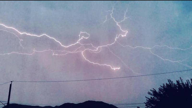
Storm systems bring hope for rain in B.C. Interior, but forecaster warns of dry lightning potential

Aug 16, 2021 | 11:48 AM

KAMLOOPS — Environment Canada says storm systems forecast to come into the B.C. Interior Monday (Aug. 16) and Tuesday could bring much-needed rain, but will also reintroduce the potential for dry lightning.

Meteorologist Geoff Coulson says the rain will not dominate the province, but will bring relief to the fire-scorched Interior where it falls.

“We’re not expecting widespread precipitation with this shower activity, but folks who do get a heavier shower or thunderstorm could see local amounts of 10-to-15 millimetres,” Coulson told CFJC Today.

The forecaster notes, however, the weather pattern is a double-edged sword.

“The concern with this — a bit of trade-off with how dry it has been and, obviously, the extremely severe wildfire situation that’s going on in the Interior — is the risk of dry lightning,” Coulson said. “Some of these storms may just generate the lightning and not much in the way of rainfall, and may actually spark a few new fires in the area.

“We know that, with some of these thunderstorms, the lightning can occur 15, 16, 17 kilometres away from the centre of the storm itself, getting into areas where there really isn’t any precipitation occurring with that particular storm cell,” he added. “Both those of us with Environment Canada on the weather side of things and, obviously, the B.C. Wildfire folks will be keeping a close eye on the lightning detection network both this afternoon and again on Tuesday afternoon.”

Jeff Pont, Kamloops Fire Rescue (KFR) Life Safety Educator, says the best thing residents can do if they spot a lightning-caused fire is call 9-1-1.

As the Tremont Creek wildfire spread east towards Kamloops, causing the Cherry Creek evacuation order and the Kamloops evacuation alert, the risk of smoldering embers and falling ash from the sky grows. Pont says residents can “FireSmart” their homes by removing anything combustible within 1.5 meters of their property.

Pont adds KFR is ready to respond to numerous lightning and ember-related fire calls.

“Everybody is super vigilant and ready to react if there’s a need be. The Juniper fire has given us a good show of what could happen, so we’ll be even better this time,” Pont says.

After the storm systems move off Tuesday night, daily high temperatures are forecast to remain in the 20s throughout the week, with the potential for rainfall returning on the weekend.

“The next weather system that we’ll be watching closely is an upper low that’s going to be coming in off the coast for the weekend, Saturday and into Sunday,” Coulson said. “It’s a little too early to tell, at this point, how widespread the shower activity with that system will be.”