Image Credit: BCCDC
COVID-19
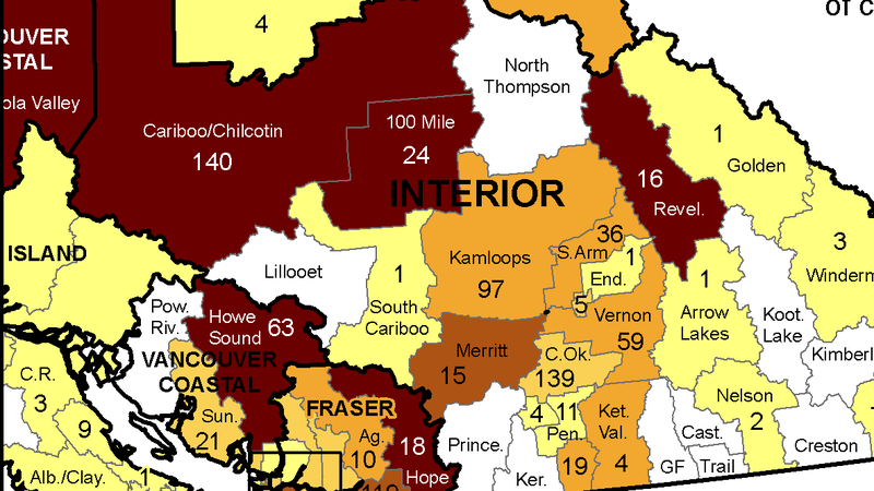
Community COVID-19 map shows 97 cases in Kamloops last week, exploding spread in Cariboo
Jan 20, 2021 | 5:33 PM
KAMLOOPS — The latest COVID-19 case data broken down by local health area paints a picture of exploding spread in the Thompson-Cariboo.
The B.C. Centre for Disease Control (BCCDC) updated its most detailed case map Wednesday (Jan. 20), for the week of Jan. 10 to 16.
It shows 97 cases in Kamloops during that time period. Considering the population of the Kamloops local health area, that is still considered moderate spread.
The more stark totals come in the Cariboo-Chilcotin, which includes Williams Lake, with 140 cases last week. The 100 Mile House local health area saw 24 cases.


