Hurricane watch in parts of Atlantic Canada as Dorian moves up U.S. east coast

Sep 8, 2019 | 6:42 AM

HALIFAX — Hurricane Dorian is expected to make landfall in Atlantic Canada Saturday with winds of 100 kilometres per hour, driving rain and pounding coastal surf — conditions that had emergency officials warning Friday of the potential for significant damage across the region.

The Canadian Hurricane Centre said Friday that a hurricane warning was in effect for central and eastern Nova Scotia, and a hurricane watch was is in effect for southwestern Newfoundland.

Tropical storm watches were also in effect for western Nova Scotia, southeastern New Brunswick, Prince Edward Island, the Magdalen Islands and northwestern Newfoundland.

“We expect it to make landfall as a hurricane and then we expect it to move towards Newfoundland into the Gulf of St. Lawrence and then become a post tropical storm at that particular stage,” said Bob Robichaud, the centre’s warning preparedness meteorologist.

“But it will be a hurricane-strength post tropical storm, meaning we still have hurricane force winds associated with that storm.”

Robichaud said initial high winds would be felt in southwestern Nova Scotia earlier Saturday with the centre of the storm expected to land near or just east of Halifax by Saturday evening.

“What we should expect are things like uprooted trees, broken trees — that may result in extended power outages,” Robichaud said.

Most regions were forecast to experience tropical storm force winds of 90 to 110 kilometres per hour. Near and to the south of the forecast track, winds were expected to reach hurricane force of 120 kilometres per hour or more.

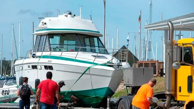
Fishermen along Nova Scotia’s Atlantic Coast expressed worries about Dorian’s potential strength as boats were moved to sheltered areas and tied together tightly.

“There’s a huge amount of activity around the dock,” said Evan d’Entremont, the 60-year-old owner of Evans Fresh Seafoods in West Pubnico, on Nova Scotia’s southwestern coast, home to one of Canada’s busiest areas of commercial fishing.

“Hopefully, we won’t have too many tidal surges,” d”Entremont said. “That’s the killer down here.”  

Most vessels in the area had returned to the wharfs by Friday afternoon. Fishermen tied them up together in long rows with secure lines and thick bumpers.

“There’s not too much you can do,” said Jamey Mood, 38, a fisherman who lives in West Pubnico.

“You have to make sure your bow and stern lines are doubled and tripled up and make sure your extra bumpers are out so that you don’t beat the other boats all to pieces …. Some boats are tied five in a row.”

Like most Nova Scotians, Mood was also busy buying propane for the barbecue, gasoline for the car and laying in a three-day store of water and non-perishable food.

Meanwhile, Max Kenney, the harbourmaster of the Cape Sable Island Harbour Authority, said he is concerned aging port infrastructure on the eastern side of the island will be ripped apart.

He estimated 90 per cent of the island’s 250 fishing vessels had been moved from the eastern side, which faces the Atlantic Ocean, to seek shelter on the western side.

“On the eastern side of our island the wharfs are 50 to 60 years old and they have been repaired rather than replaced, while our boats for lobster fishing have gotten larger and longer,” said Kenney. “The wharfs just won’t stand it. I’ve always said, ‘We’re one big storm from a disaster,’ especially on that side of the island with the conditions of the wharf.”

The forecast was calling for severe winds and torrential rain, with a major impacts for southeastern New Brunswick, Prince Edward Island, Nova Scotia, western Newfoundland and Quebec’s Lower North Shore. The highest rainfall amounts — 50 to 100 millimetres — were expected over western Nova Scotia, western Prince Edward Island, extreme eastern and southern New Brunswick and the Magdalen Island.

In Fredericton, New Brunswick Premier Blaine Higgs announced the cancellation of the Conference of New England Governors and Eastern Canadian Premiers that had been scheduled to begin Sunday in the port city of Saint John.

“As with past emergency situations we are asking all New Brunswickers to be prepared and to heed the advice of safety officials,” Higgs said. “We should pick up extra water and non-perishable food items. Make sure you have fresh batteries for your flashlights and radios and make sure your cars are full of fuel.”

Greg MacCallum, the director of New Brunswick’s Emergency Measures Organization, warned against localized and flash flooding, especially in the province’s southeast.

“That is a real possibility and it needs to be anticipated and thought about because it can be devastating,” he said.

Large waves were expected for the Atlantic coasts of Nova Scotia, Newfoundland and for eastern portions of the Gulf of St. Lawrence, while a storm surge, combined with large waves and pounding surf, could potentially cause flooding in parts of Nova Scotia, P.E.I., Newfoundland, and the Magdalen Islands.

With rough seas forecast, the Commander of Maritime Forces Atlantic said a group of NATO warships visiting Halifax were pulled out of port Friday afternoon, while a spokesman with the Halifax Port Authority said four cruise ships had cancelled a Saturday visit to the port.

Maritime Atlantic also cancelled its Saturday ferry crossings between Cape Breton and Newfoundland.

In Nova Scotia, the RCMP issued a public safety appeal, warning of hazardous conditions, decreased visibility and conditions for hydroplaning on roads and highways.

“The RCMP encourages the public to maintain a safe viewing distance along beaches and shorelines, well away from the water’s edge and stay completely off rocks, breakwaters, and piers where waves are breaking,” the Mounties said in a news release.

As of late Friday afternoon, Dorian was positioned off North Carolina and was moving northeast at 32 kilometres an hour with maximum sustained winds of 148 kilometres an hour.

Keith Doucette and Michael Tutton, The Canadian Press