More rain forecast for flood-weary communities in Ontario, Quebec, N.B.

Apr 27, 2019 | 8:22 AM

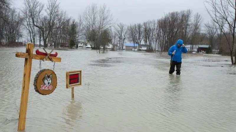
OTTAWA — It’s shaping up to be another anxious weekend for flood-weary communities in Eastern Canada, with more rain in the forecast for an area stretching from cottage country north of Toronto, all the way to the Acadian Peninsula.

Montreal, Ottawa and many smaller communities across the expansive flood zone have declared states of emergency, prompting the federal government to deploy hundreds of soldiers to help with sandbagging and other relief operations.

Prime Minister Justin Trudeau is set to tour Constance Bay, the riverfront village west of downtown Ottawa that has seen the worst flooding so far, on Saturday morning. He is expected to help with sandbagging and receive a briefing from officials in charge of the fight against the flood.

Despite a night that gave Ottawa and Gatineau, Que., a break from rain, water levels around the capital region are expected to rise half a metre higher than they did during a 2017 flood that was thought to have been a once-in-a-century event.

A morning report from the board that monitors levels in the Ottawa River says near Constance Bay, water levels are just shy of their 2017 levels and are forecast to rise another 47 centimetres. At a measuring spot near Parliament Hill, where paths and parking lots along the river are already underwater, the board forecasts a rise of another 75 centimetres before water levels peak on May 1.

Rising river levels forced the closure Saturday morning of a heavily travelled bridge onto the Island of Montreal. Quebec’s Transport Department announced it was closing the Galipeault Bridge, a western access point to Montreal along Highway 20.

The department said in a statement that the closure is for an indefinite period. Traffic is being diverted to another bridge farther north, but the department asked motorists to avoid the area.

A close eye is also being kept on a hydroelectric dam, on a tributary of the Ottawa River between Ottawa and Montreal, that’s at risk of failing. Water at the Chute-Bell dam has reached levels expected to occur every 1,000 years, but Hydro-Quebec says it’s confident the structure is solid.

Meantime, a bit of relief is in sight for flood-weary residents of southern New Brunswick, with the latest forecast calling for waters to slowly recede in most areas over the next five days.

Geoffrey Downey, a spokesman for New Brunswick Emergency Measures Organization, says while it’s raining across much of the province today, officials aren’t expecting a lot of precipitation.

He says the five-day flood forecast is for the Saint John River to be below flood stage in Fredericton, and down to flood stage in Maugerville, Oak Point and Saint John, by Thursday.

In southern Manitoba, the rising Red River has forced some road closures and a small number of evacuations but earlier predictions for major flooding between the U.S. border and Winnipeg haven’t come to pass.

The Canadian Press